Eva Almquist, our 3rd cousin’s awesome wife, continues to give me great information on the Almqvist Rampekärr farmland (mentioned first in this post). She pointed me to a Swedish website that had historic land records. 23 dollars (or 150 krona) later I now have a copy of all 31 pages of records that outlines the rights to the land.
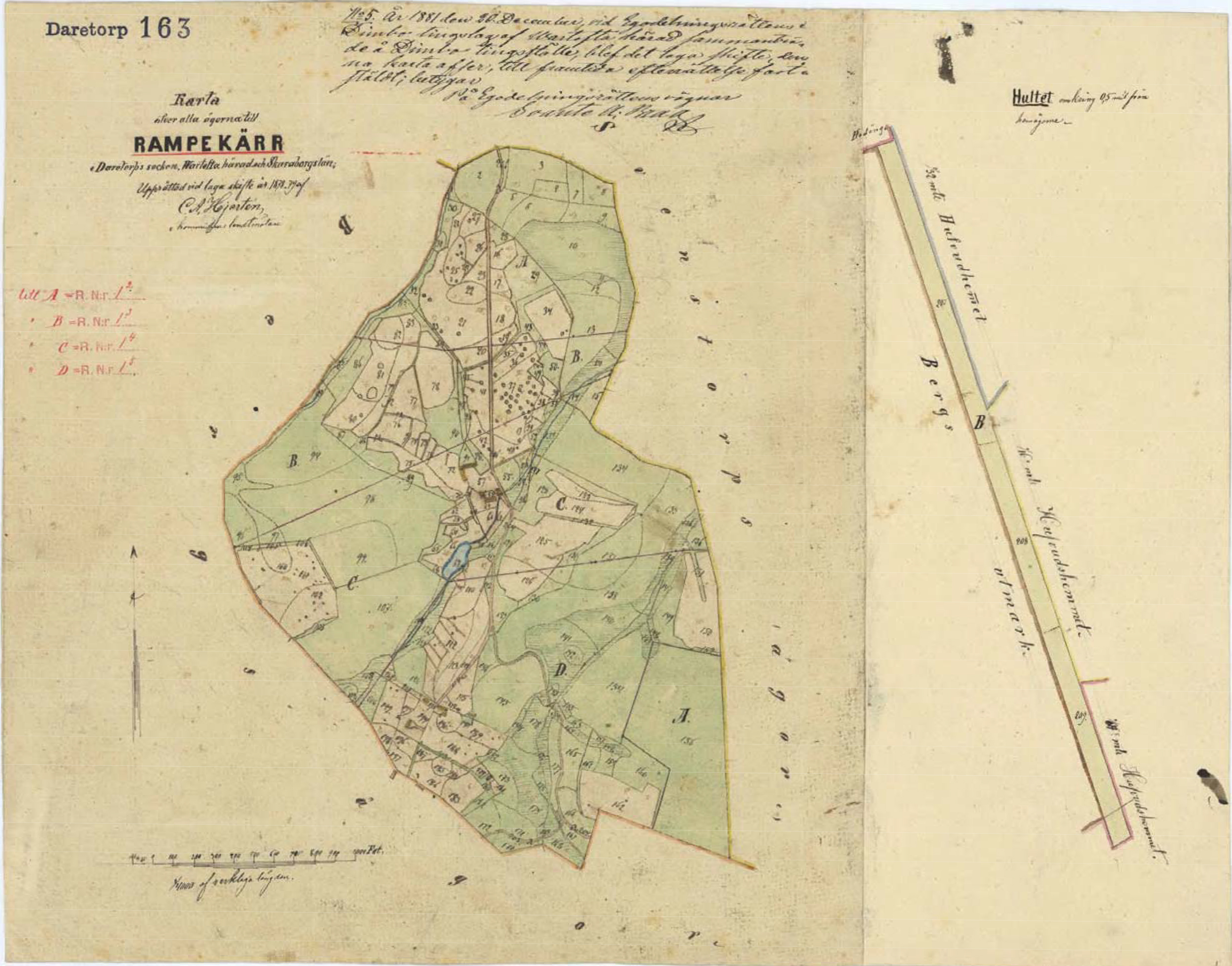
The assessment was drawn up in 1878 and ratified in 1881; my great-great-great grandfather Lars Petterson died in 1878. This makes me think that this map was drawn up as part of parceling out his lands to his descendants. I haven’t translated any of the accompanying 31 pages yet, but have skimmed them and found the names of three of his sons (and thanks again to Eva) one of his son-in-laws. After Swedish tradition, his sons went by the last name of Larson as you can see on this page, which divides up the parcels (or at least some type of rights to them).
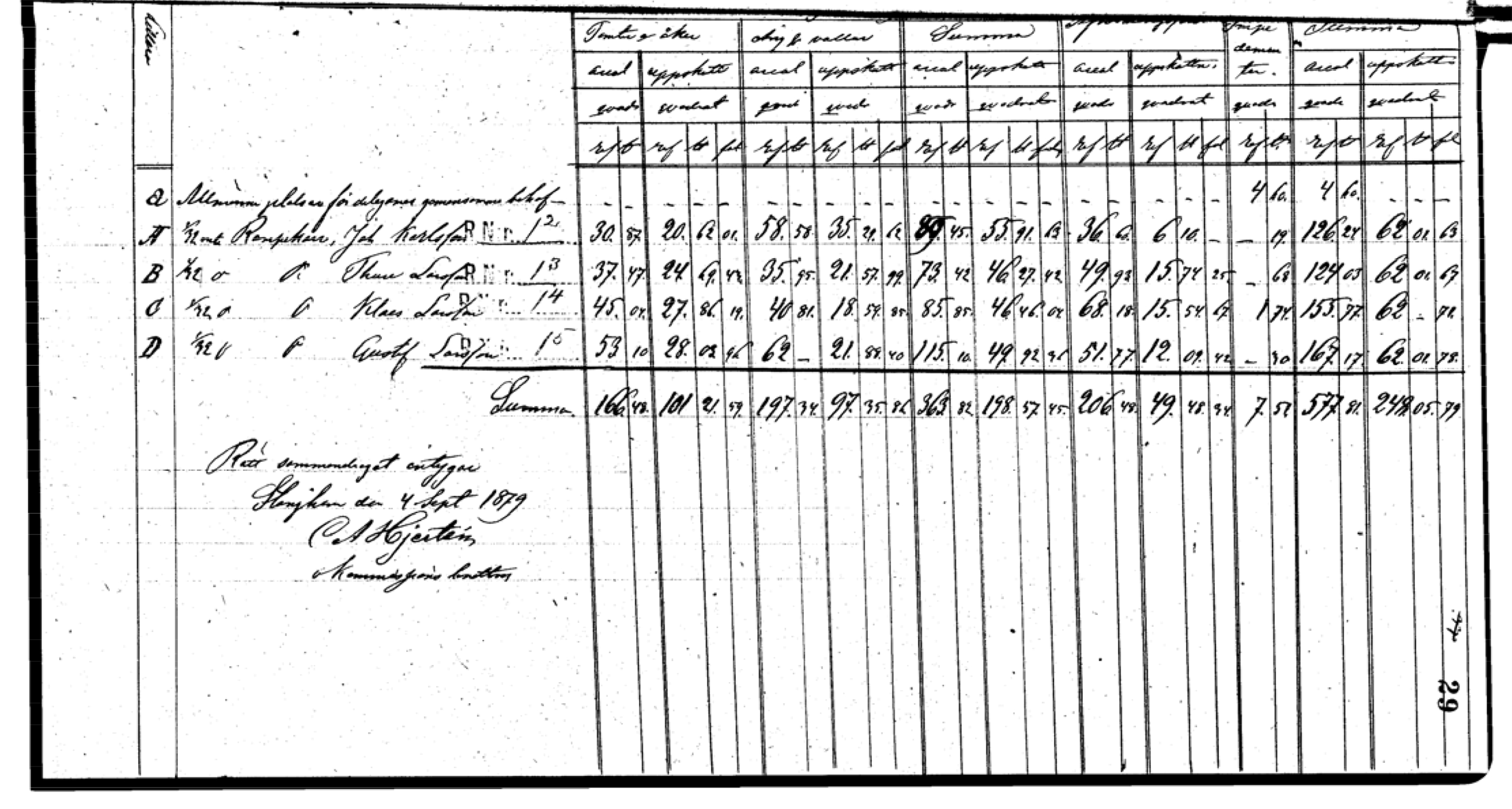
As you can see on the map the land was divided into four sections, A, B, C, and D and given to each son.
- Johan (Gustav) Larson, the eldest son of Lars
- Thure (Alfred) Larson the fourth son
- Klas (Petter) Larson (my great-great grandfather) the second son
- Johannes Karlsson, the husband of their sister Clara Albertina.
Lars’ third son, Laurentius (Eva’s husband’s great-grandfather) entered the priesthood, so did not inherit rights to land.
Klas’ land, C, ends up being about 52 acres, with what looks like many structures, a pond, and smaller parcels that are described in the 31 pages, variously as gardens, parks, etc.
Where is the Almqvist name in all of this? My next post delves into that sticky wicket.