 My recent post about the reconstructed migration route of the McMurrys from Kentucky to Indiana (Armchair Highway Archaeology) got me thinking—how might the McMurry family have gotten to Kentucky in the first place?
The five surviving children of my 6th-great-grandparents, William McMurry (ca 1725–1798) and Agnes(?) (1730–after 1772), were said to have travelled to Kentucky together around 1787–1788: John (1752–1832), James (1760–1832), Thomas (1765–1829), Jane (1767–1835), and Robert (1772–1812). What would have been the most direct available route from the McMurry’s home(s) in Fincastle, Augusta (now Botetourt) County, Virginia, to their new homes in central and southern Kentucky? Kentucky in the late 1700s had far fewer choices in terms of routes, so I decided to start there and work my way back to Virginia.
The Wilderness Road was the primary means of entry into Kentucky. As a result of his pioneering exploration of central Kentucky beginning in 1769, Daniel Boone had determined the best route into Kentucky. This route started at the Anderson Blockhouse (see photo below) on the Holston River, just east of Big Moccasin Gap. The Wilderness Road crossed into southern Kentucky through the Cumberland Gap, a mountain pass through the Cumberland Mountains region of the Appalachian Mountains.
On March 10, 1775, Daniel Boone set out from the Anderson Blockhouse with a team of 35 axmen to turn this route into a passable road that would make the settlement of Kentucky easier. Two weeks later, on March 24, 1775, Daniel Boone and his team had blazed about 180 miles of trail and were just 15 miles from their intended endpoint when they were attacked by Shawnee indians. This attack proved to be the first of many over the next two decades.
Daniel Boone had been hired by the Transylvania Company to build a road into Kentucky to spur settlement of the land. The Transylvania Company had purchased Kentucky from the Cherokee and Iroquois nations, who, along with the Shawnee, had signed a treaty in October, 1774, agreeing to no longer lay claim to the land or hunt in Kentucky. The Shawnee were joined by the Lower Cherokee (also known as the Chickamauga) in 1776, who not only resented the treaty, but also sided with the British in the Revolutionary War. This alliance led to the Chickamauga wars, a series of ambushes, raids, campaigns and outright battles waged on the settlers who travelled the Wilderness Road.
The hostilities continued for 18 years, until 1794. So for the first two decades of its existence, the Wilderness Road had to be travelled cautiously and defensively, in large and well-armed groups, often relying on fortified wooden structures called “stations” that had been built along the Wilderness Road. Adding to the difficulty of traveling the Wilderness Road was the fact that it wasn’t passable by wagons until 1792; before then, the road could only be traversed on foot or by horseback.
A great overview of the road can be found in William Allen Pusey’s 1921 book, The Wilderness Road to Kentucky: Its location and features. William Pusey was the great-grandson of the pioneer Alfred Brown, who travelled the Wilderness Road in 1782 and kept a journal of his experiences on the road, which William Pusey inherited.
Family lore places the date of the McMurry migration to Kentucky at around 1787–1788, which would have been when the Chickamauga wars were in full swing. While purely speculative, it’s possible that their experience traveling to Kentucky at this time was at least part of the reason why the McMurrys appear to have done much of their subsequent relocating en masse over the next half-century. If a travel date of 1787–1788 is correct, then at the time of their travel to Kentucky, the ages of the McMurry siblings would have been:
- John (35 years old)
- James (27 years old)
- Thomas (22 years old)
- Jane (20 years old)
- Robert (15 years old)
A check of relevant dates and associated places indicates that the timing of the McMurry migration(s) wasn’t as straightforward as family tradition maintains. My 5th-great-grandfather, Thomas McMurry, was already in Kentucky by 1784, as witnessed by his March 20, 1784, marriage to Catherine “Kitty” Robinson. In fact, all four of Thomas and Kitty’s children were born in Kentucky between 1785 and 1790.
Janice Maddox states that Thomas had been given a grant (of land) for his work on guard duty in 1780, while the boundary line between Kentucky and Tennessee was being surveyed. If this is indeed the case, Thomas would have already been in Kentucky by 1780, when he was only 15 years old.
Sister Janet “Jane” McMurry, on the other hand, appears to have ventured to Kentucky a bit later. She was married to John Patrick Reed in Augusta County, VA, on August 12, 1788, indicating that they hadn’t left Virginia yet (or perhaps they left and had already returned by then).
The 1904 memoir “Reminiscenses, Historical and Otherwise” by John Fletcher McMurry (grandson of elder sibling John McMurry) was recently (just in the last couple of months) found and transcribed by Janice Maddox. In this memoir, John F. McMurry writes about his grandfather (elder sibling John McMurry) settling in Kentucky:
…later perhaps about 1787 or 1788 went to the county of Kentucky, took up a claim in what is now Marion County, near the present sight of Bradfordsville; spent the summer on his claim, cleared a small piece of land, raised some corn, and in the fall returned to Virginia and spent the winter. The buffalo, deer, turkeys, etc., appropriated his corn in his absence. It seemed to have been one of the conditions required of those desiring to locate a claim on publics lands, to evidence an earnest of their good intentions they must do some work on the land and grow some crop. Hence, his indifference as to what became of the crop.
So despite what I would imagine would have been a harrowing journey over the Wilderness Trail, at least one of the siblings chose to journey over it at least three times. Of course, having spent much of his first season on his land just (partially) clearing the land, there would not have been much time left to weatherproof his house, plant and harvest sufficient crops, forage, salt and put away meats, process hides, chop sufficient firewood, and all of the other tasks necessary to overwinter on the frontier.
It seems likely that the McMurrys would have entered Kentucky through the Cumberland Gap along the Wilderness Trail, but would that have taken them all the way to their destination(s)? From what I’ve been able to determine so far, the Wilderness Road ran right past Logan’s Fort (now being recreated in what has since become Stanford, Lincoln County), where Thomas and his wife Kitty settled. From there, Bradfordsville (where James and John settled) was only another 20-25 miles to the west.
How did the McMurrys get to John Anderson’s Blockhouse, the beginning of the frontier on the Wilderness Trail? While the Anderson Blockhouse marks the start of the frontier on the Wilderness Road, the Wilderness Road itself extended quite a bit further to the east and north. There’s a modest amount of controversy over where exactly the Wilderness Road began. Some say it begins at the Anderson Blockhouse; others say the Wilderness Road began at the point where the road became too narrow for wagons, forcing travelers to abandon their wagons around Bristol, VA; still others say the Wilderness Road extends as far north as people called it the Wilderness Road (as in “this road takes you to the wilderness”), which in this case is the area around Roanoke and Salem, VA, where several roads met and diverged. Even today, this road (in a more modern, paved form) is officially called Wilderness Road in many cities along the way: Newbern, Radford, Dublin, London, and several others.
Once the Wilderness Road reached Salem and Roanoke, it converged with what was a major transportation artery of the time—the Great Wagon Road (also known as the Great Philadelphia Wagon Road, the Great Valley Road, or the Valley Road of Virginia). The 1751 Fry-Jefferson map (“A map of the most inhabited part of Virginia containing the whole province of Maryland with part of Pensilvania, New Jersey and North Carolina, drawn by Joshua Fry & Peter Jefferson in 1751”) shows a road they called “The Great Road from the Yadkin River thru Virginia to Philadephia”, which would have referred to the Great Wagon Road. The Fry-Jefferson map is shown below twice, as it was published, and with the Great Wagon Road highlighted:
The Great Wagon Road ran very near the McMurry home in Augusta County, Virginia; in fact, the Cow Pasture River (highlighted in pink in the image below), where Jane McMurry was born in 1767, can be seen in just to the west of the Great Wagon Road (highlighted in dark blue in the image below). Cow Pasture River runs nearly parallel to the Great Wagon Road, about 15 miles to the west of the road. I believe that the McMurry family lived somewhere in the area around or between Fincastle and the (mouth of) Cow Pasture River (see image below).

Relation of Fincastle (bottom) and the Cow Pasture river (top, in blue). The location of the Great Wagon Road is shown with a pink line.
Using methods similar to those I used in my last attempt at reconstructing a historical migration route, I carefully reconstructed the route of the Wilderness Road and the Great Wagon Road between the area of the McMurry home near Fincastle and the Cow Pasture River to the Anderson Blockhouse at the entry to the western frontier, and then into the Kentucky frontier to Logan’s Fort, where at least some of the McMurry siblings appear to have settled, at least for a while.
I began by using lists of towns and features mentioned in early travelers’ accounts of the road, early maps of the route (such as the 1794 map of Kentucky, above), and historical descriptions of the road. I strung these places together on a small-scale map, to use as a starting point for mapping the route. I then went in at a larger scale and made best guesses as to the oldest road through an area, making use of topographic clues as well as enduring traces of roads that can be followed in areas where the road has been abandoned or obscured by subsequent urban development. I then went in at an even larger scale and looked for any hints I could find in the modern names of roads for the route I was tracing out.
As a check of this hypothetical route, I then overlaid the oldest detailed road maps I could find for the area—in this case, USGS topo maps from 1885–1895 (or 1903 or 1909 when an earlier topo map couldn’t be found) and verified that the roads I selected were indeed present in 1885–1895. In this case, the older topo maps predated the automobile, so the roads were, quite literally, few and far between, making the verification of the route quite straightforward. In total, only one segment of the route (measuring about 5 miles long) hadn’t been mapped by USGS by 1926—the area around Crab Orchard, Kentucky.
Key to map:
- Pink: Great Wagon Road
- Yellow: Virginia portion of Wilderness Road
- Red: Wilderness portion of Wilderness Road
- Light blue: Road to Fincastle
- Dark blue: Cow Pasture River
- Green: Road to Richmond, VA
The following image shows just that portion of the map that the McMurry route would have traversed.
 I’ve broken their journey into three segments:
- From Fincastle to Great Wagon Road and then to the beginning of the Wilderness Road at the Salem/Roanoke junction.
- The Virginia portion of the Wilderness Road, from the Salem/Roanoke junction to John Anderson’s Blockhouse.
- The Wilderness portion of the Wilderness Road, from John Anderson’s blockhouse to Central Kentucky.
Below, I’ll give just a brief overview of each of these segments. I’ll keep it short because this post has already grown quite long. If you’d like more descriptive detail of any (or all) of the segments of their route, please let me know in the comments section at the end of the post.
Some notes on the following fly-over movies of the Kentucky migration route:
Note 1: Apologies for the skittishness of the line marking the route in the videos below; it seems I need a more powerful computer to render these as smoothly as I’d like. To see these route tours in higher resolution, just download any of my original kmz files (links below) and open them in Google Earth.
Note 2: To make the topography easier to visualize, I’ve exaggerated relief by a factor of 2 in this and the following videos.
Note 3: For smoothest play back, buffer the movies first by pausing them for a few seconds (or minutes, depending on your connection speed).
Segment 1: Setting out from home
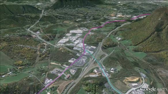
The first segment consisted of a fairly short (8.8 miles), gentle, mostly uphill walk from Fincastle to the Great Wagon Road. From there, it would have been another relatively short (9.2 miles), mostly downhill trip along the Great Wagon Road to the junction with the Wilderness and Richmond roads around Salem and Roanoke.

Download the kmz file for this segment (to view in much greater detail in Google Earth)
Segment 2: Heading towards the frontier on the Wilderness Road
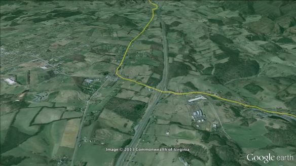
The second segment was 181 miles long, along the Wilderness Road from Salem to the John Anderson Blockhouse, the gateway to the Kentucky wilderness. The first 93 miles were mostly uphill, and the rest was mostly downhill.
Download the kmz file for this segment (to view in much greater detail in Google Earth)
Segment 3: Into the Kentucky wilderness on the Wilderness Road
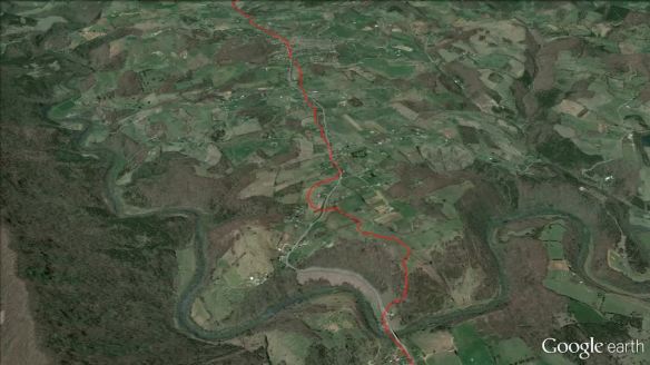
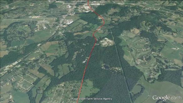
The third and final segment was the longest (189 miles), the most physically challenging, and the most dangerous, as the travelers would have been under threat of attack by indians (Shawnee and Southern Cherokee) all along this last segment. The last segment began at John Anderson’s Blockhouse and ended at Logan’s Fort (now Stanford, KY). This road started in the mountains and ended in the relative flatlands of central Kentucky. The hardest portion of this segment would have come between mile 26 and mile 40, and the Cumberland Gap would have marked the approximate half-way point between the Anderson Blockhouse and Logan’s Fort.
I divided this video into two parts due to its size. Part one, from Big Moccasin Gap to the Cumberland Gap, is below:
Part two, from the Cumberland Gap to the end of their journey at Logan’s Fort, is below:
Download the kmz file for this segment (to view in much greater detail in Google Earth)
Alternately, download the kmz file for the entire route (to view in much greater detail in Google Earth)


I’ve enjoyed reading your well-researched article on the McMurrys’ migration from Virginia to Kentucky. I’m a descendant of John McMurry, son of William, through his daughter Margaret who married John Scanland. I assume you have the book, “McMurry Family – Descendants of William and Mary McMurry” edited by Marilyn A. Bone. I contributed most of the family records in the first 86 pages of that book, which cover the descendants of John. I don’t recall ever seeing or hearing that the maiden name of Mary, wife of William the supposed immigrant, was “Ulrey” and am wondering where you were able to find that information.
Hi John,
First, thanks for the comment—it’s always great to get feedback and to hear from a new (to me) family history researcher. I’ve got to admit that I’m relatively new to the McMurry genealogy before 1835; I thought I was treading an information desert on that line, and I’ve just recently discovered a bunch of folks (now including you) who are researching or have previously researched the earlier McMurrys.
I’m starting fold in some of that research into my own genealogy database (from which I draw on for these posts), but I suspect I haven’t seen most of what’s out there already. I’m working my way through the RootsWeb archives, and I’ve seen many references to “The McMurry Book”—good and not-so-good—in those posts. I’ve never actually seen the McMurry Book myself, but now that you’ve given me the editor, I may have better luck finding a copy. If you know of an electronic version of that book (or other McMurry sources), please do let me know!
The “Mary Ulrey” turns out to have been an unsupported assertion that I picked up somewhere along the way, and just this past week I removed that name from my database after starting to go through one of Don McMurray’s Timelines. I’ll revise my blog post this weekend to remove that (and also possibly revise some of the birthdates).
Thanks again for reaching out. I’ll send you an email momentarily in case you’d like to communicate and/or exchange information outside of this comments section.
Take care,
Michael
I just wanted to thank you for the very nicely done portrayal of the journeys of your McMurry family through visual mapping. I am not descended from the McMurry family but was just looking on Google under images for the Cowpasture River in Augusta County, Virginia. My Redman family lived in the area according to land deeds so it was very nice to get a visual map to show not only Cowpasture River but also Calf Pasture area where other Redman family had land. If I run across any McMurry names in my researching I will send them your way. Thanks again. Your visuals have helped me greatly in my viewing where they came from.